
Waterways and the Métis Nation
Subject: Social Studies
Topic: Waterways that had a historical impact on Métis
Time Frame: 2-45 minute periods or 90 minutes
Objectives:
- Students will be able to identify historical waterways of the Métis.
- Students will participate in the creation of a map mural that will be used throughout this unit.
- Students will be able to research the significance the waterways had and the role the Métis played within the fur trade.
Methodology: Teacher Lecture, Individual Work and Group Cooperation.
Materials:
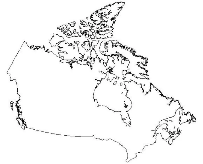
- Blank map of Canada
- Atlas/map of waterways
- Overhead projector and transparency of backline map of Canada
- Large piece(s) of paper to cover a bulletin board
- Pencils, pens, crayons, markers
- Internet & library access
Space Requirements: Classroom, and areas where students can separate into small groups.
Background Information: Water for Aboriginal peoples is the basis of all life. At the beginning of time, the Creator gave instructions to Aboriginal peoples to respect water, air, and the earth by keeping it pure. These original instructions are reflected in Aboriginal culture, beliefs and values. Northwest Coast Indians located village sites on key rivers and shores. Totem poles are vivid expressions of their respect and dependence on the land, water and sky.
Aboriginal peoples consider many places close to water sacred. On a height of land in northern Manitoba, there is a pond from which water flows east into the Hayes River, and west into the Nelson. This is the Echimamish, "theriver-that-flows-both-ways." In tribute to the almost mystical reversal of flow that made portaging between the rivers so easy, First People left offerings each time they crossed this divide. Offerings could include tobacco, food or cloth or other such things. It was important to show respect to the water since water is considered a sacred element.
The primary source of travel throughout Canada was the waterways, it was the waterways that connected the large country and enabled people to travel great distances. Water travel was also the primary source of communication throughout Canada, community information and letters were given to the people traveling throughout the wilderness in canoes and York boats. Prior to contact it was the waterways that were used as massive trade routes for First Peoples, these trade routes and the concept of trading and bartering was something that occurred since time immemorial.
Throughout the 1800s the fur trade became something that was the basis of economy and it was trading companies that utilized the Métis as Voyagers. The Métis were a new nation that came about through the marriage of French or Scottish men mostly with Cree women (some other tribal affiliations as well). The Michif language was also a new language that was introduced by the Métis which was a combination of Cree and French. It was the marriage and country marriages to Cree women that solidified the fur trading routes throughout the country. The children of these marriages were often sent out east or to the Old World (Europe) to become educated.
A famous historical Métis is Louis Riél; he was educated in the east and became one of the founding fathers of Manitoba and was instrumental in bringing government to the west. Louis Riél was hung for treason to Canada in Regina, but that conviction has since been repealed and Riél is recognized for his contributions to the establishment of the Prairie Provinces. The Red River settlement, which is near what is now called Winnipeg, was an important trading route for fur traders.
First Peoples were instrumental in showing the fur traders the waterway routes throughout Canada and it is this intrinsic connection with the land and the waterways that Canada was settled and became a country. The Métis were instrumental not only in acting as scouts for the various fur trading endeavors but they were also able to use their family connections to the first people to ensure that fur traders were dealt with. Kinship ties were very important. The trading companies encouraged the intermarriage of their Scottish or French employees to the First Peoples women. There were often policies with the trading companies where “temporary country wives” were encouraged. If the trader went back to his homeland, the company would take care of the wife and children, often sending the male children to be educated in the east. Around company posts English, French, Scottish and Irish men, with First Nation wives who were mostly Cree, fathered a new people, the Métis. Along inland water routes French-Cree, Ojibway and Saulteaux Métis dominated, with most of these children being raised within their First Nation communities. They were taught their connection to the land and to nature and that the role water played was important. Water was not only a trading route but it was also something that had a spirit and needed to be respected.
The Saskatchewan River with its ease of access and navigation from Lake Winnipeg became the primary gateway to the rich fur-bearing regions beyond. In addition, the Saskatchewan River provided access to other important navigable rivers in northern Saskatchewan; i.e., the Churchill River system as well as the Clearwater River which provided access to the Lake Athabasca basin. Within the span of a little more than a decade, numerous forts had been established on the principle trade routes and traders were traveling on virtually all of the rivers.
The location of the Saskatchewan River basically formed the southern limit of the Woodlands and the Precambrian Shield country - the prime fur bearing regions. Other more southerly rivers like the Assiniboine & Qu'Appelle Rivers were explored and harvested for furs but did not have the reach or the connections to other waterways like the Saskatchewan River did. As well, they were prone to seasonal fluctuations in water level and shifting sand bars. Other possible routes such as the Seal River or the easterly portion of the Churchill were much more hazardous to navigate. The demise of the canoe as the principle form of transportation in the northwest happened almost as quickly as its arrival. Overland transportation like ox cart, horse, and train began to replace water transportation as the primary mode of travel, although in isolated regions the canoe remained prominent well into the twentieth century. The decline in the European demand for furs also contributed to a changing pattern of trade and travel as did the diminishing supply of furs. It is remarkable indeed, that most of the waterways which the explorers and traders used remain in much the same condition as they were centuries ago. Evidence of their lives still remains: forts, portages, debris of spills, etc.
Canada's Aboriginal populations are profoundly linked to water and waterways for both physical and spiritual health. Today the quality of many water systems is degraded by the pressures of human development. To many Aboriginal people, this degradation of the land results in the deterioration of their health and way of life, while providing them with few off-setting benefits.
Directions/Procedure:
- Read through the background information and visit the websites related to the subject area. Use the background information and other notes gathered to introduce the concept of the Métis and the waterways to your class. As you direct lecture and present this topic allow your students to engage in conversations regarding the information that they have been presented. Find an atlas with the waterways: Churchill River, Red River, North and South Saskatchewan Rivers, Lake Athabasca, Lake Winnipeg, Hayes River, Nelson River, Echimamish (River-that-flows-both-ways). Have students converse about the significance these rivers had in the fur trade and how the Métis were instrumental in their role of introducing waterways. (15 minutes).
- Using transparency and a projector, have the class label the rivers on the Canadian Black line map provided at the end of this lesson. Use the map of waterways or an atlas as a guide. Ensure that the waterways are labeled. (15 minutes).
- Divide the class into four groups; assign each group two rivers to research. Using the overhead projector and a bulletin board covered with paper trace the Canadian map onto the paper (a fifth group or perhaps two students could trace this onto the paper). Each group would choose one person to draw and label the waterway they have been assigned on the mural map. The other members of the group will research their waterway either on the Internet or in the library. A one paragraph report is to accompany each river. Students are to look in their research for the connections of the Métis nation to the waterways and the role that the Métis played. This would mean two paragraphs per group. (45-60 minutes).
- Each group will present an oral report on their assigned river and explain how that waterway was viewed by the historical Métis. These presentations could take 5 minutes each
Evaluation: At the end of this unit is a suggested evaluation form for teachers to adapt to fit the needs of their students.
Optional or Add On:
- Research the role that the Red River Settlement had on the fur trade. Look into the particular questions below and have students research and provide oral reports on the subjects.
- How were the Métis instrumental in the development of a country?
- What role did Louis Riel play in the development of Canada?
- What significant role did the Métis have in the fur trade?
Date ______________ Name _____________
Operation Water Spirit 5
Using the map provided draw and label the following historical Métis waterways: Churchill River, Red River, North and South Saskatchewan Rivers, Lake Athabasca, Lake Winnipeg, Hayes River, Nelson River, Echimamish (River-that-flows-both-ways)
Name ___________
Date ______________
Research and find information on a historical waterway. While you do your research keep these questions in mind.
Name of river or waterway
What was the role this waterway played in the fur trade?
What were the settlements that were found along the waterways?
Who were the First Peoples whose traditional territories were located along the waterway?
Additional Information: